Mother Nature is preparing to play a few tricks of her own this week – beginning today.
The National Weather Service in Dodge City is calling for cold temperatures and snow to start out the week. Highs are forecast to remain near or below freezing through Thursday.
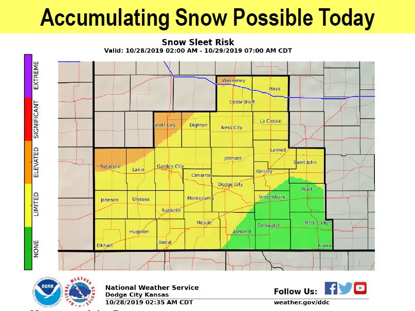
Light snow showers are expected today, with up to an inch of accumulation possible in far western Kansas and west-central Kansas.
The heaviest snow today will be west of a WaKeeney to Lakin line. While widespread travel issues are not expected, the NWS is urging drivers to be cautious on untreated and secondary roads.
More light snow is expected Tuesday night into Thursday morning. Another inch of accumulation could be possible.
There also is an elevated ice risk Tuesday and Wednesday.
The weather is expected to dry out later this week, with temperatures climbing back into the upper 40s.