By TIGER MEDIA NETWORK
Multiple weather agencies and meteorologists are beginning preparations for what could be an active day of severe weather Friday in Kansas.
While commencement ceremonies Friday and Saturday mornings at Fort Hays State University are not expected to be interrupted by severe storms, evening plans both nights might need to be monitored.
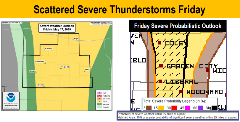
Hays and most of western Kansas is in a slight risk for dangerous weather Friday late afternoon and evening. On Saturday, western Kansas has a marginal risk for severe weather.
Storms Friday, if they are able to fire up, could produce large hail and gusty winds – and perhaps a tornado.
“They’ll form to the well west of Hays and move east with time,” said Marc Russell, a meteorologist with the National Weather Service in Dodge City, which covers Ellis County.
“It’s just going to depend on the heating of the day and how that helps things develop. It might be too warm aloft to get them going.”
The dryline is expected to set up over western Kansas on Friday, providing a fueling point for the storms in the late afternoon and evening.
The NWS said the main threat will be large hail and damaging winds – as well as a few tornadoes.
“Tornadoes will be isolated,” Russell said. “The bigger threat will be hail and wind. There could be winds up to 70 mph. There will be more of a widespread event Monday with rain.”
Portions of Nebraska and west Texas are expected to get the brunt of the storms Friday. Both of those areas are listed in enhanced threats, according to the Storm Prediction Center.
But western Kansas could see hail up to the size of baseballs with some storms, which is large enough to cause significant damage to crops, animals, vehicles and buildings.
“Any storms that do form will have the possibility of large hail,” Russell said.
He said the Hays area will have a better chance of measurable rain Monday, when storms are expected again. Highs are expected to be in the lower 60s on Monday, with a 70% chance of thunderstorms.
Highs Friday are expected to be near 90, with highs near 80 on Saturday. Sunday is expected to top out at about 70 degrees.
While severe weather hasn’t had much of an impact on the Hays area so far this spring, Russell said now is the time of year when that usually changes.
“Really in mid-May to mid-June is the peak season for areas in the Plains,” he said.