Story by ADIA REYNOLDS Graphic by HANNAH CRAWFORD
Tiger Media Network
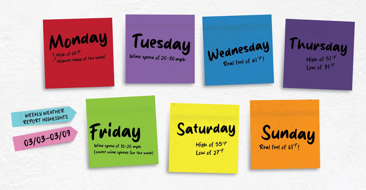
The upcoming week reflects similar weather patterns as the week prior, with mild daytime temperatures and chilly nighttime temps. Highs and lows will remain steady, though winds are predicted to spike Tuesday and Sunday.
There is a small chance for precipitation early in the week.
“One small Sunday storm, but it is energetic,” said Bill Turner, a meteorologist with the Dodge City National Weather Service. “Tuesday night will also bring north winds, rain or wet snow.”
Turner said it is unlikely the Tuesday storm will bring anything substantial, and it is expected to blow through Kansas quickly.
However, the storms are not predicted to have severe impacts for the area.
“We flipped the pattern completely,” Turner said. “We’re entering meteorological spring (March 1 through May 31), and it’s unlikely we’ll see any more Arctic fronts.”
Weekly Look Ahead:
- Monday: HI 65 /LO 42 with a real feel of 55
- Wind Speed: 15-25 mph
- Tuesday: HI 51/ LO 29 with a real feel of 41
- Wind Speed: 20-30 mph
- Wednesday: HI 51 / LO 26 with a real feel of 41
- Wind Speed: 20-30 mph
- Thursday: HI 51/ LO 31 with a real feel of 50
- Wind Speed: 10-20 mph
- Friday: HI 54 / LO 29 with a real feel of 43
- Wind Speed: 10-20 mph
- Saturday: HI 55 / LO 29 with a real feel of 54
- Wind Speed: 10-20 mph
- Sunday: HI 62 / LO 34 with a real feel of 61
- Wind Speed: 10-20 mph
More information can be found via the National Weather Service.